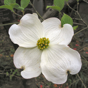
Virginia State Flower Dogwood Blossom
Virginia State Seal
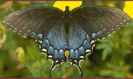
Virginia State Insect Tiger Swallowtail Butterfly
Virginia Flag
Virginia State TreeDogwood
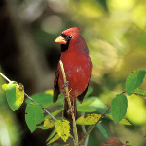
Virginia State Bird Cardnial
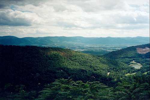
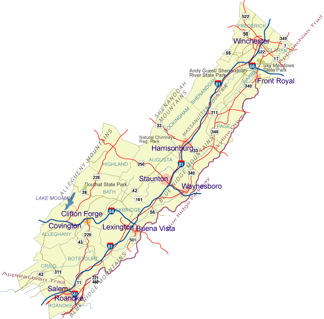
Shenandoah Valley
Virginia State Song "Carry MeBack ToOld Virginia"
Virginia County Formation Maps
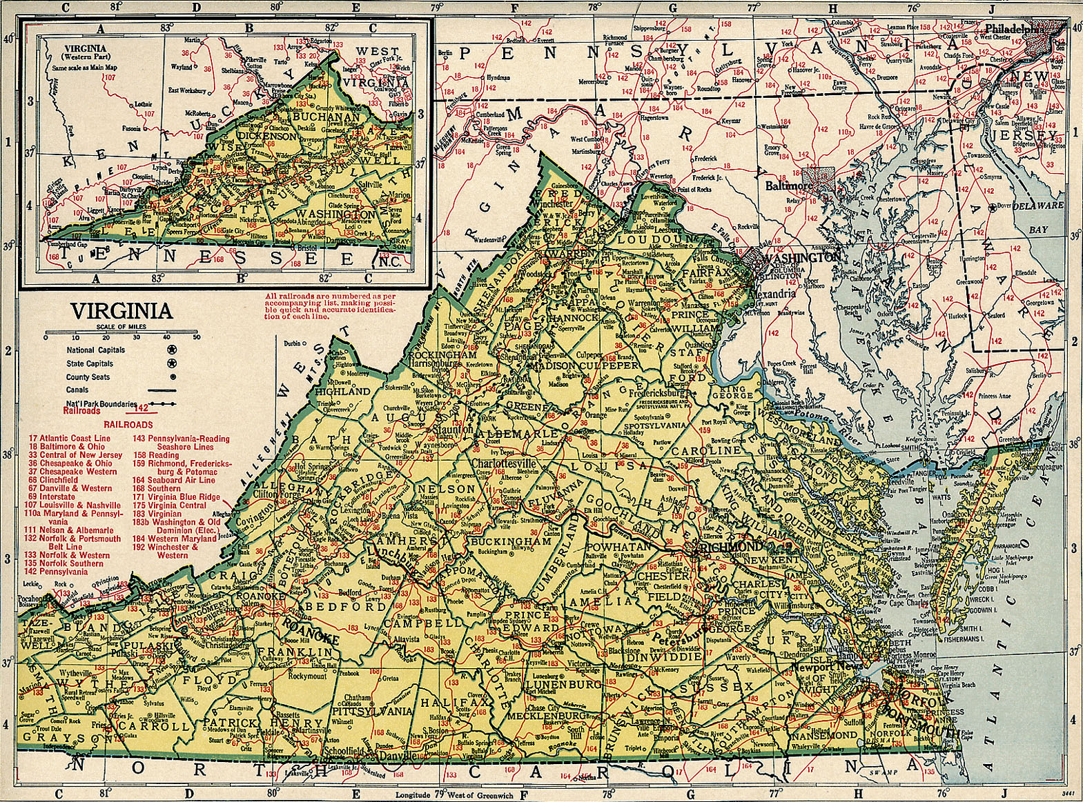
Virginia Railroad Map 1944
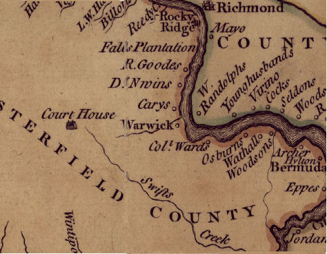
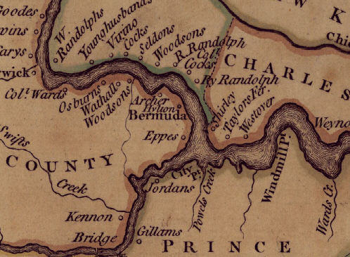
W. Randolph Map
Virginia
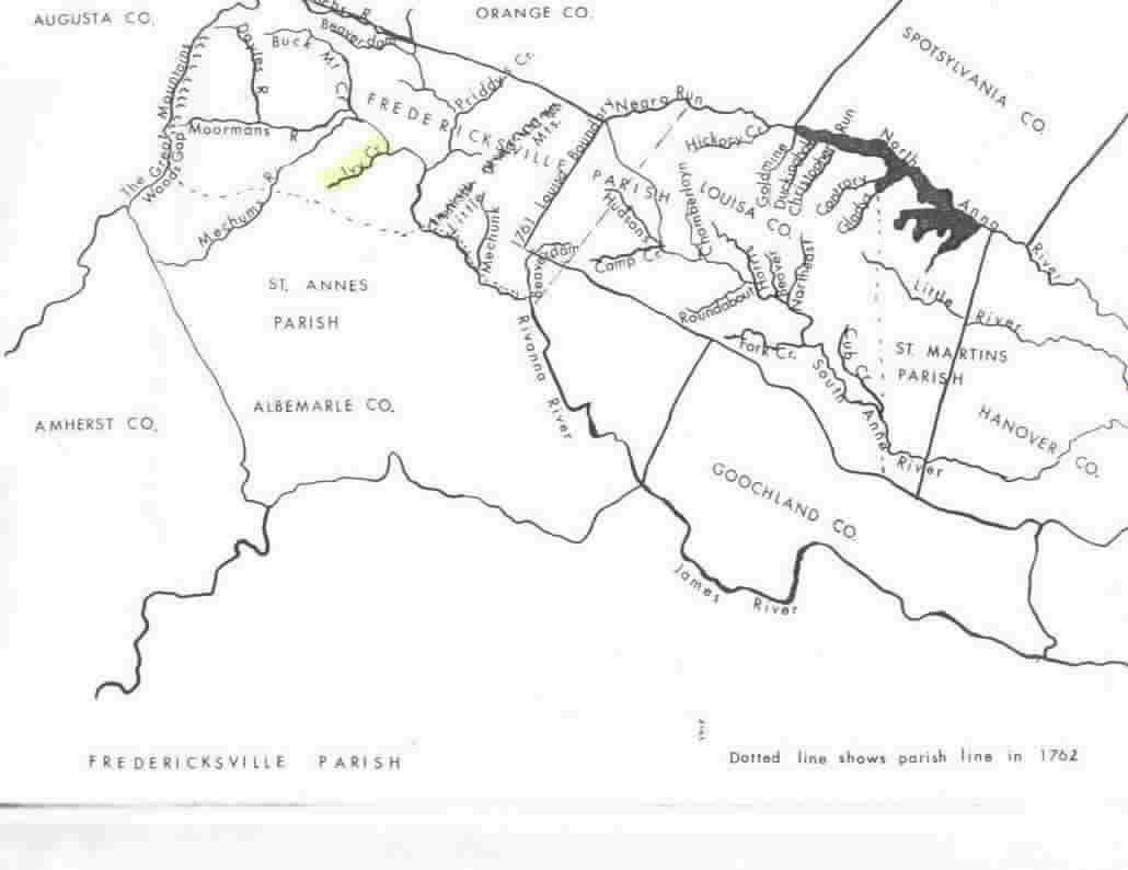
St. Ann's Parish Boundary
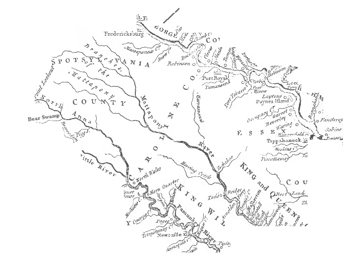
Caroline Creeks
James River
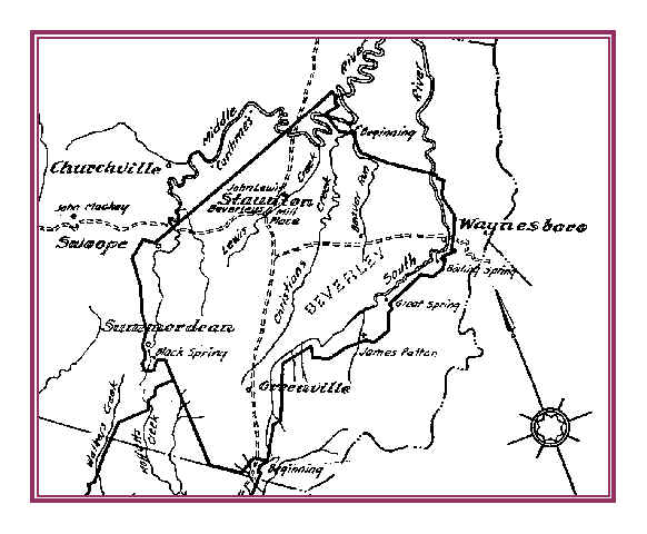
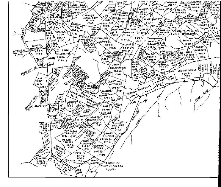
1736 Beverly Land Grant
1736 Beverly Patent
1862 Randolph Map
1907 Virginia Map
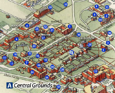
UVA (?) Grounds Map
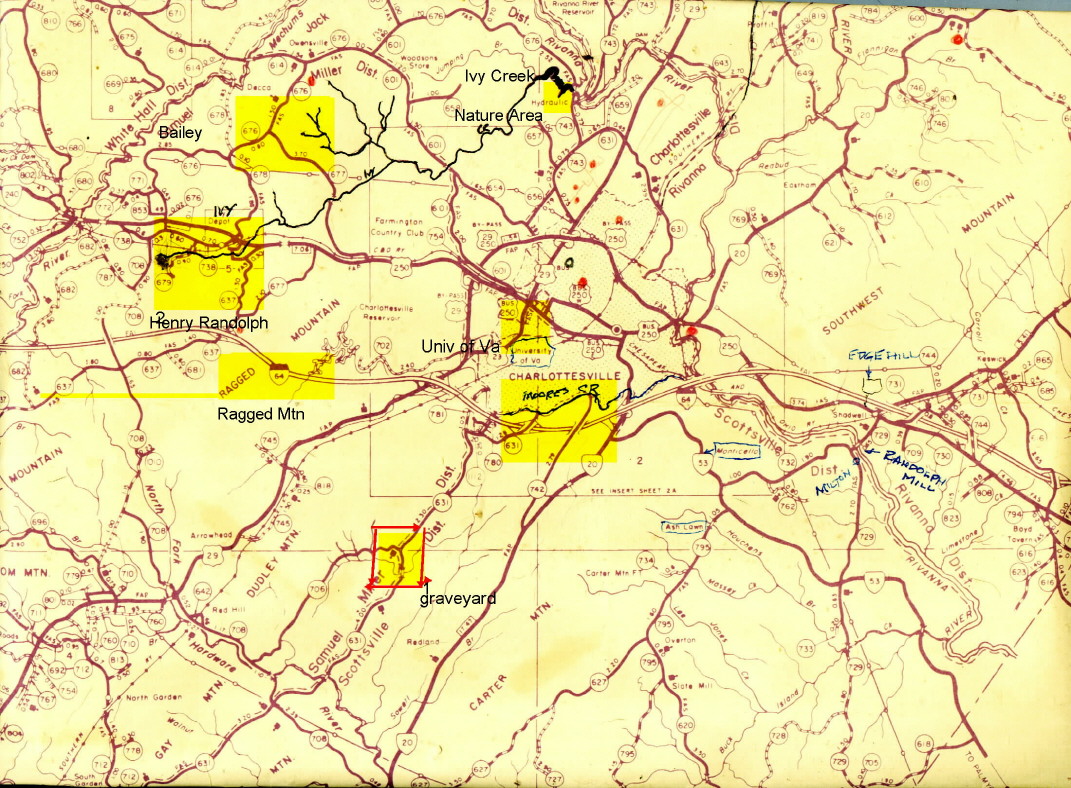
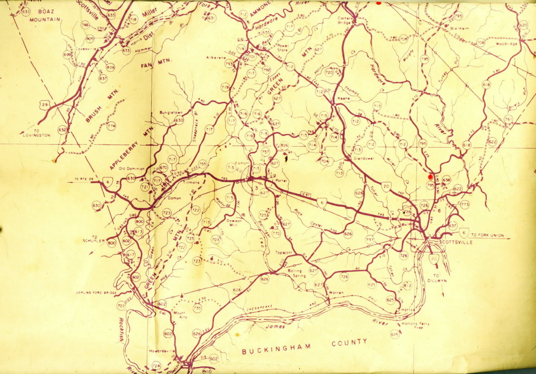
Albemarle County Areas of Interest
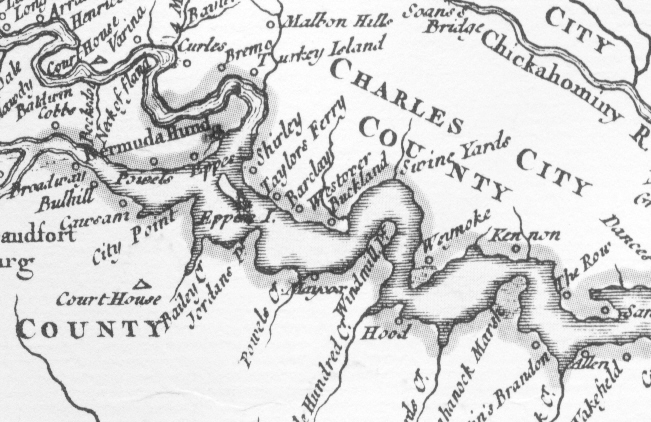
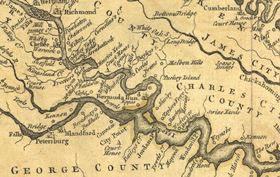
Bermuda Hundred
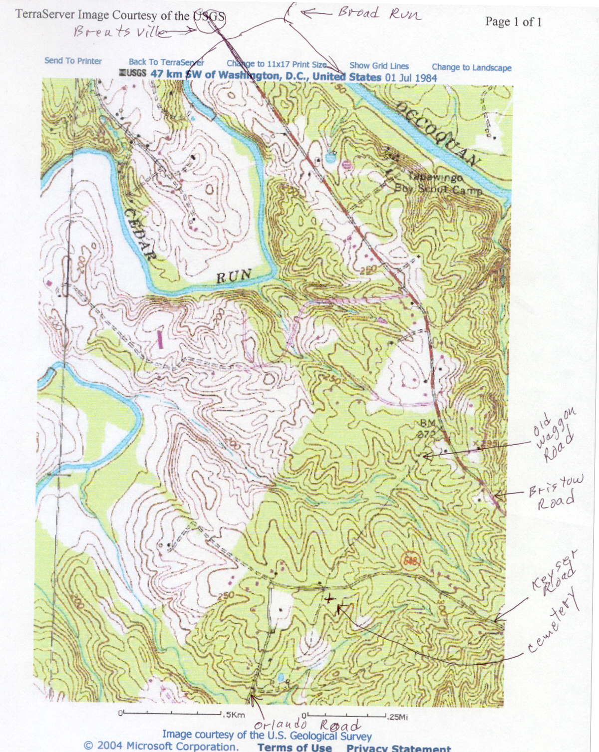
Cedar Run
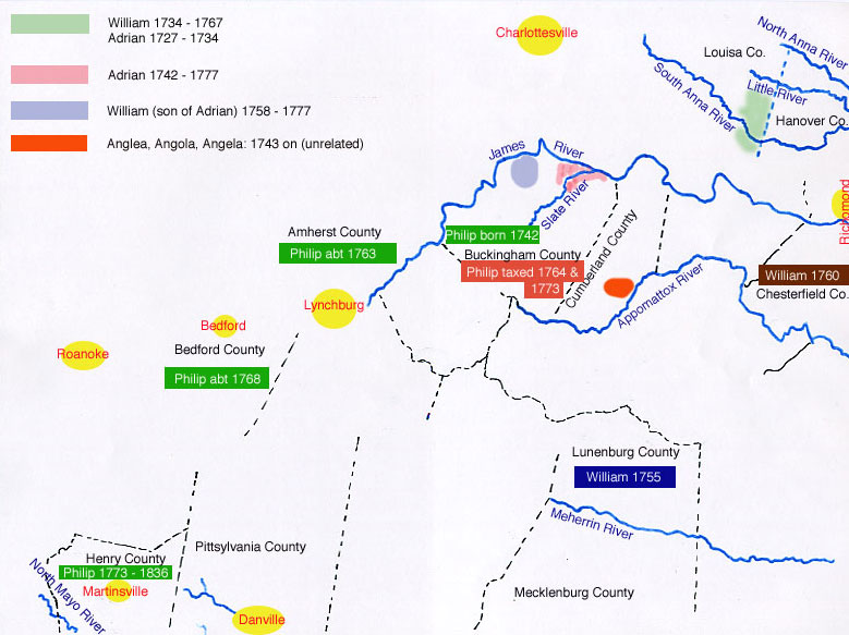
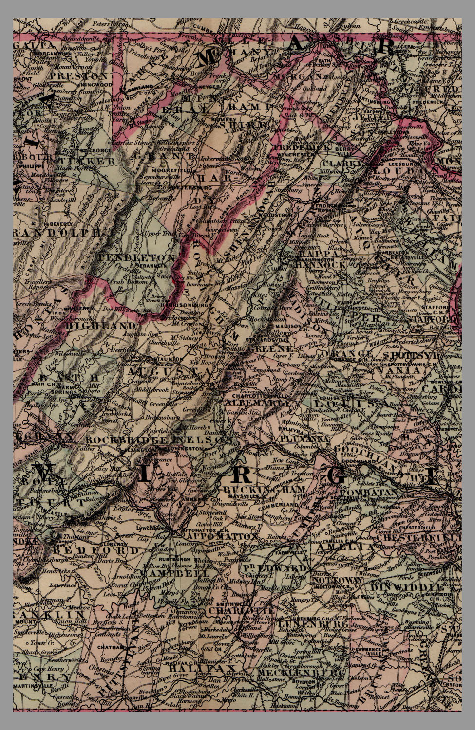
Central Virginia #1
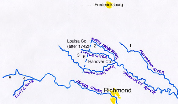
Central Virginia #2
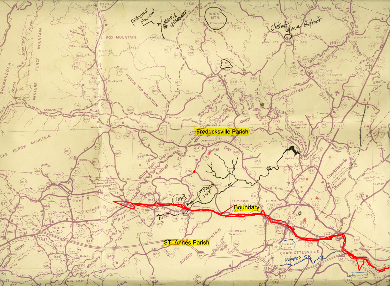
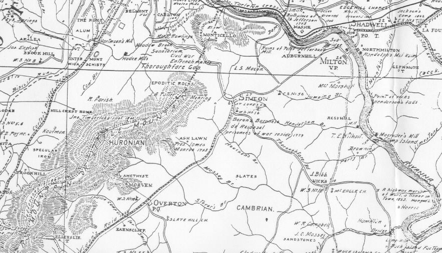
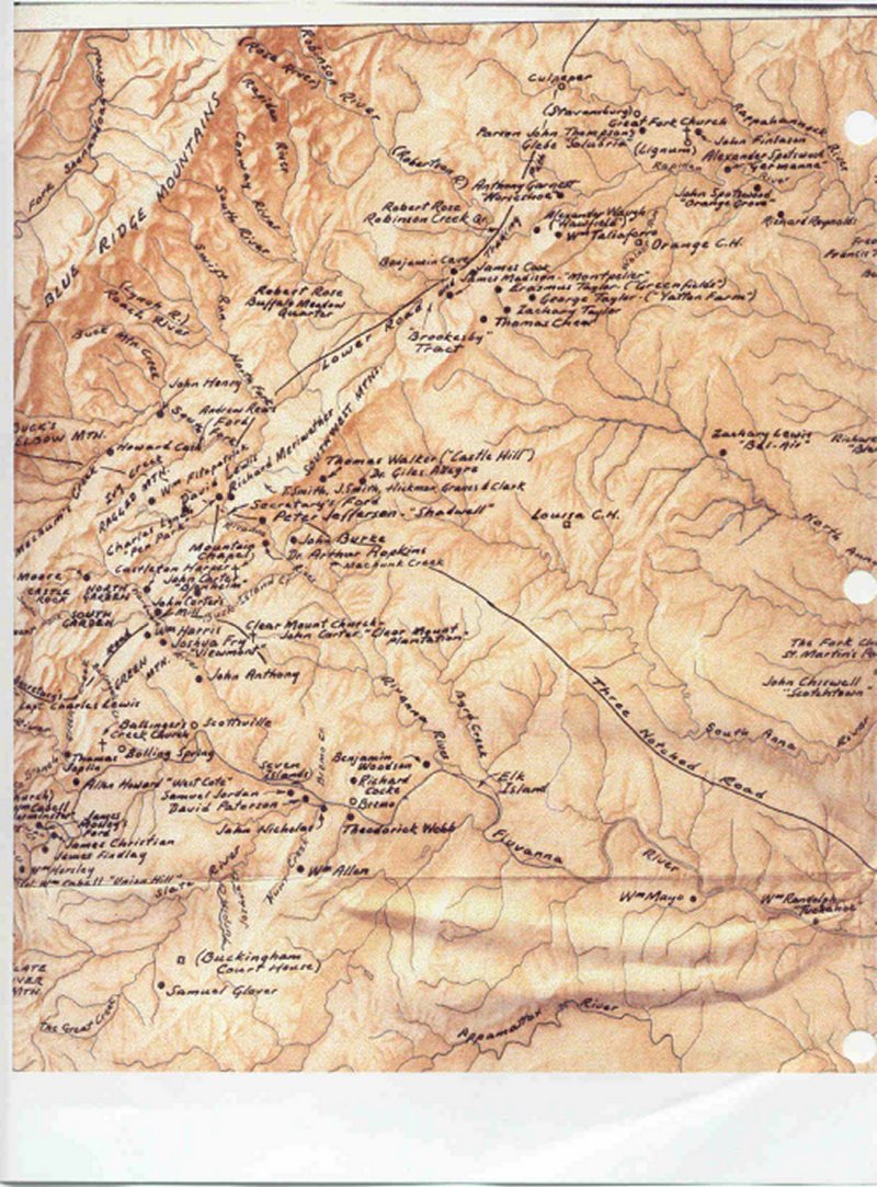
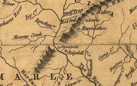
Charlottesville Area ca. 1700
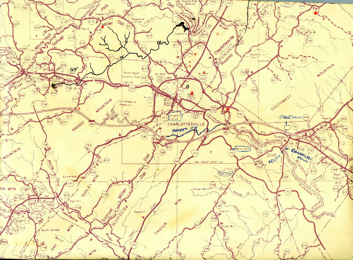
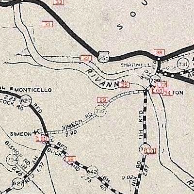
Charlottesville Area
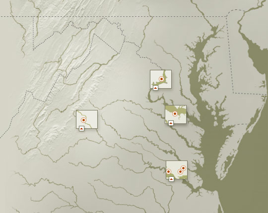
Chesapeake Bay Area Rivers
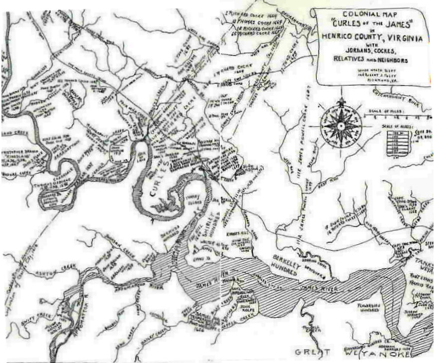
Curles Map
Dungeness
Homes Around Monticello
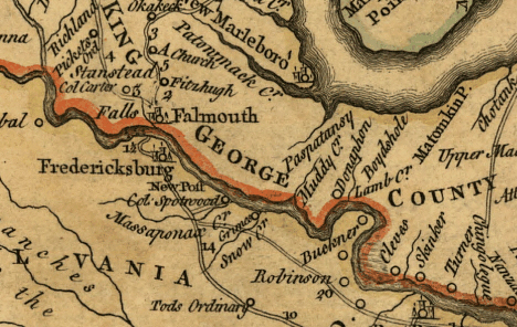
Fitzhugh/Carter Map
Fredericksville
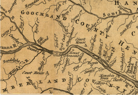
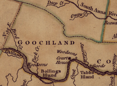
Goodson James River
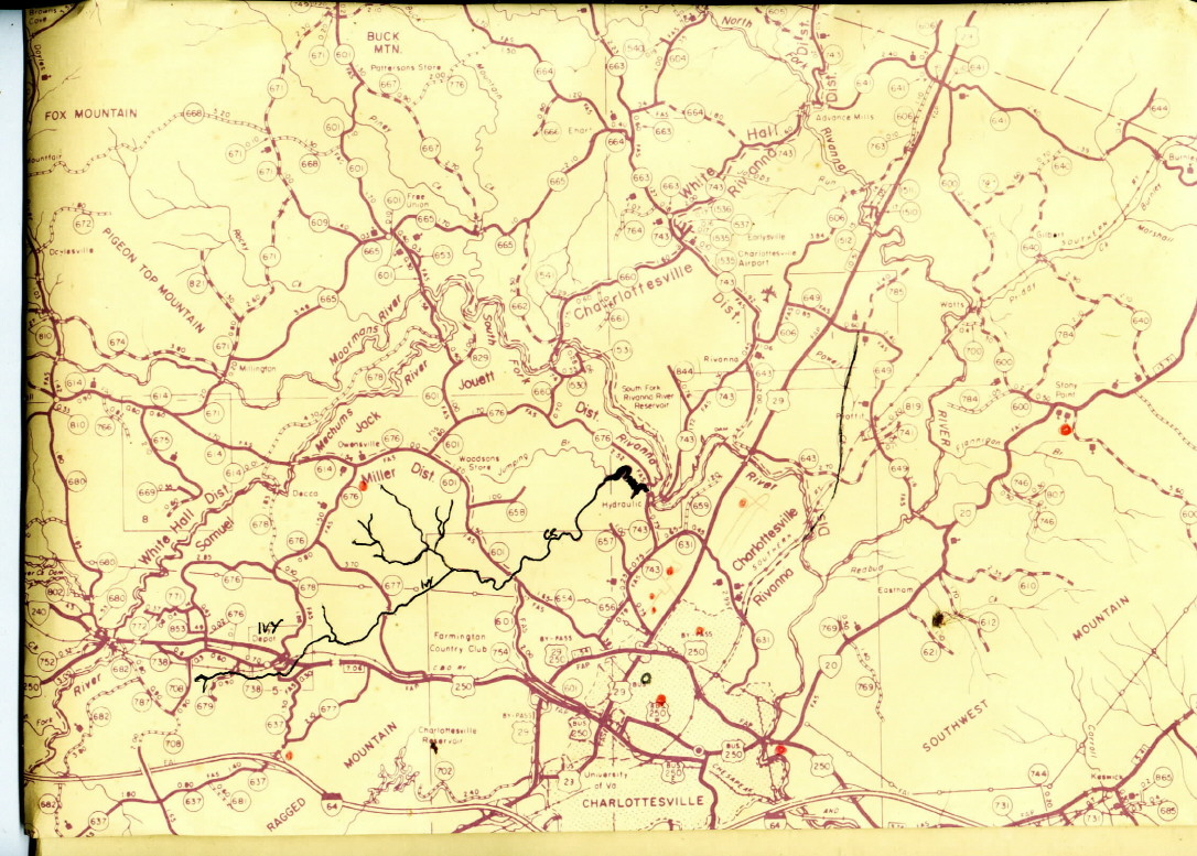
Ivy Creek #1
Ivy Creek #2
Ivy Creek #3
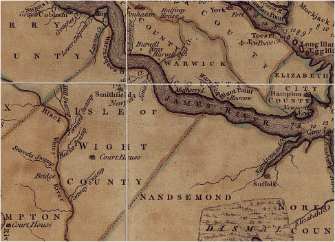
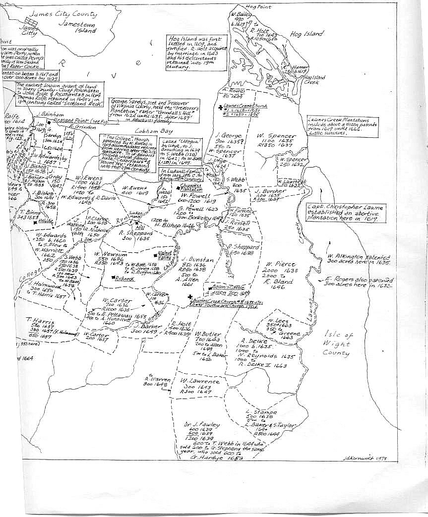
Isle of Wright
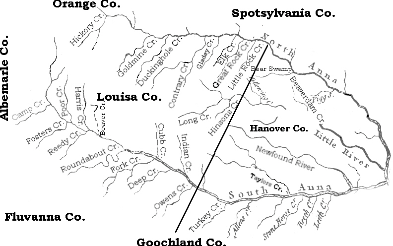
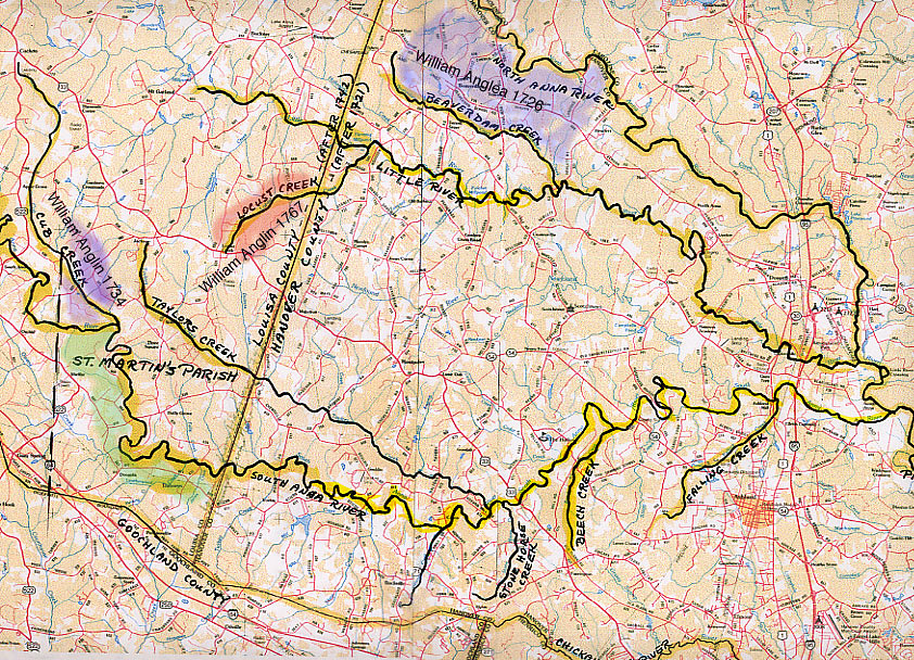
Louisa County Creeks
Lower Albemarle County
Carter Map
Central Virginia
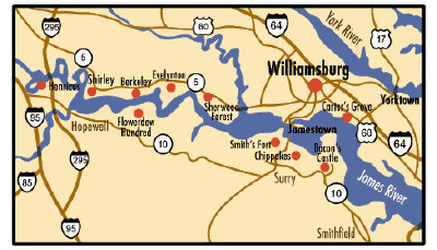
James River Plantations
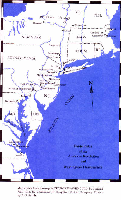
Revolutionary War Battlefields
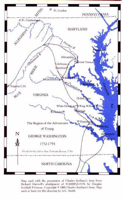
Virginia Region 1732-59
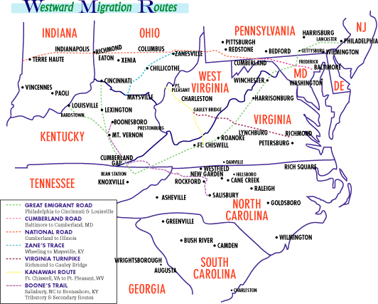
Migration Routes
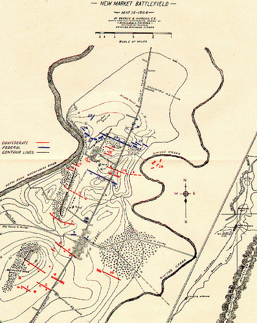
New Market Battlefields
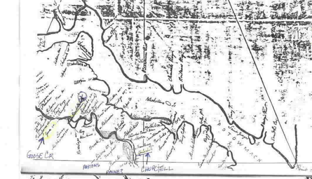
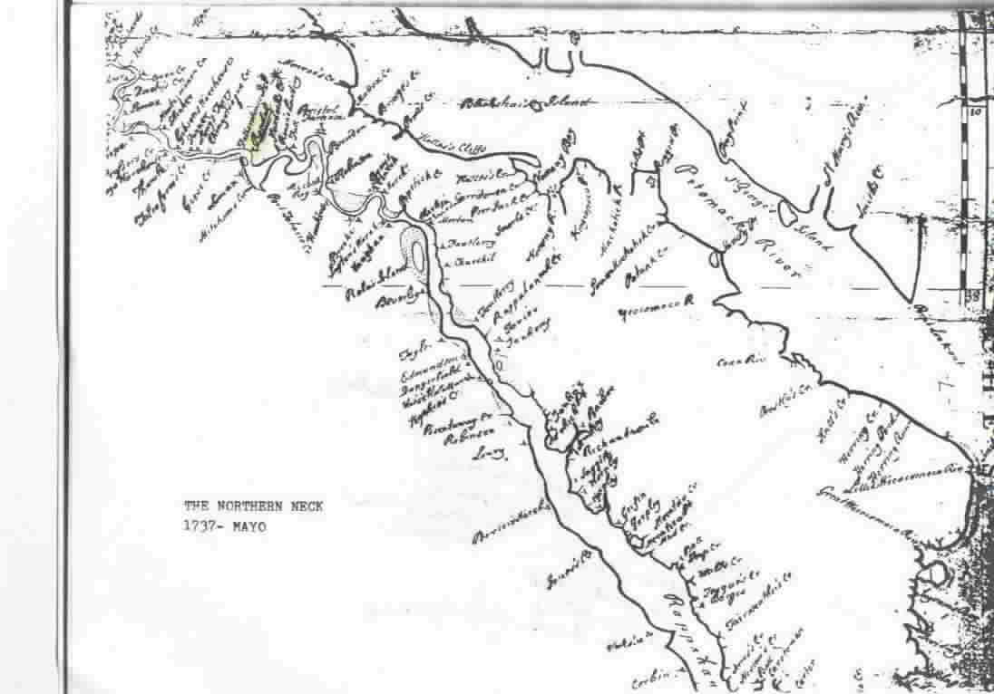
Northern Neck #1
Northern Neck #2
Northern Neck #3
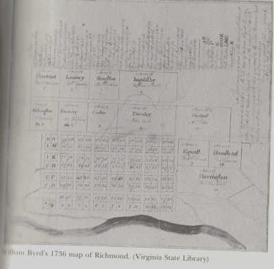
Richmond Map 1736
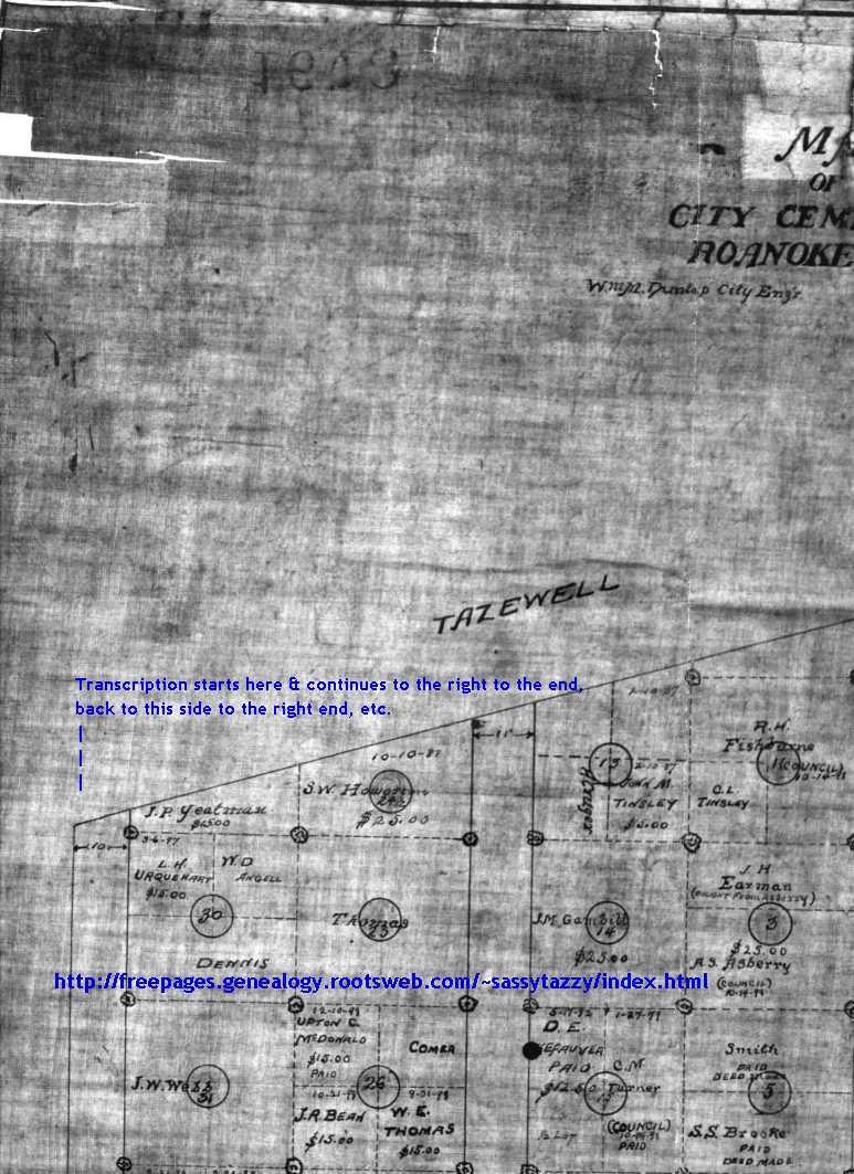
Roanoke City Cemetery
Ry and W Randolph
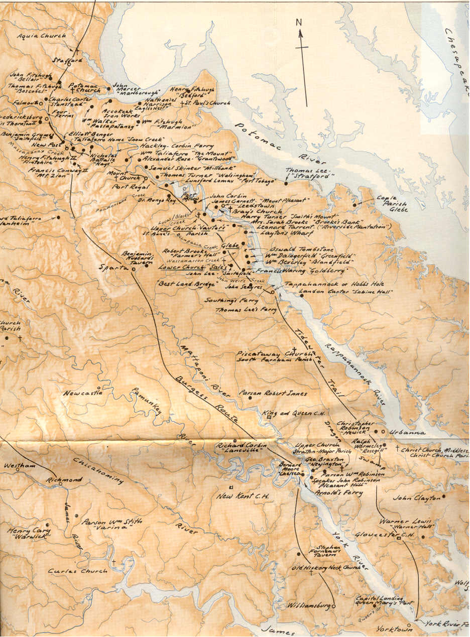
Tidewater to the Valley #1
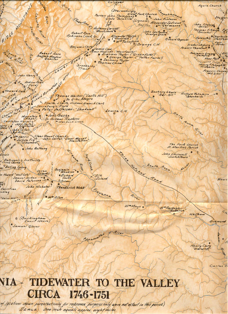
Tidewater to the Valley #2
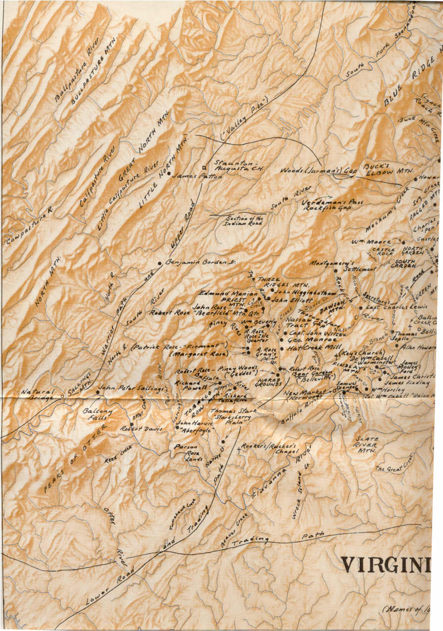
Tidewater to the Valley #3
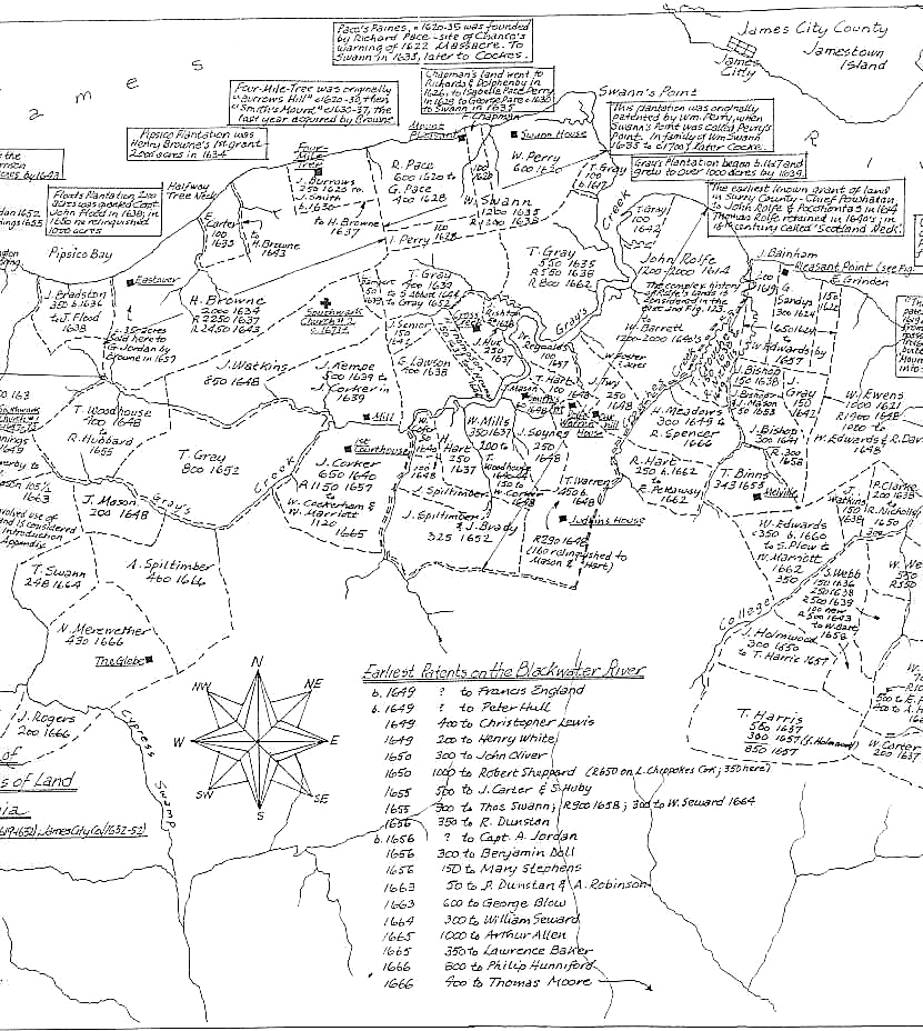
Surry County Land Patents #1
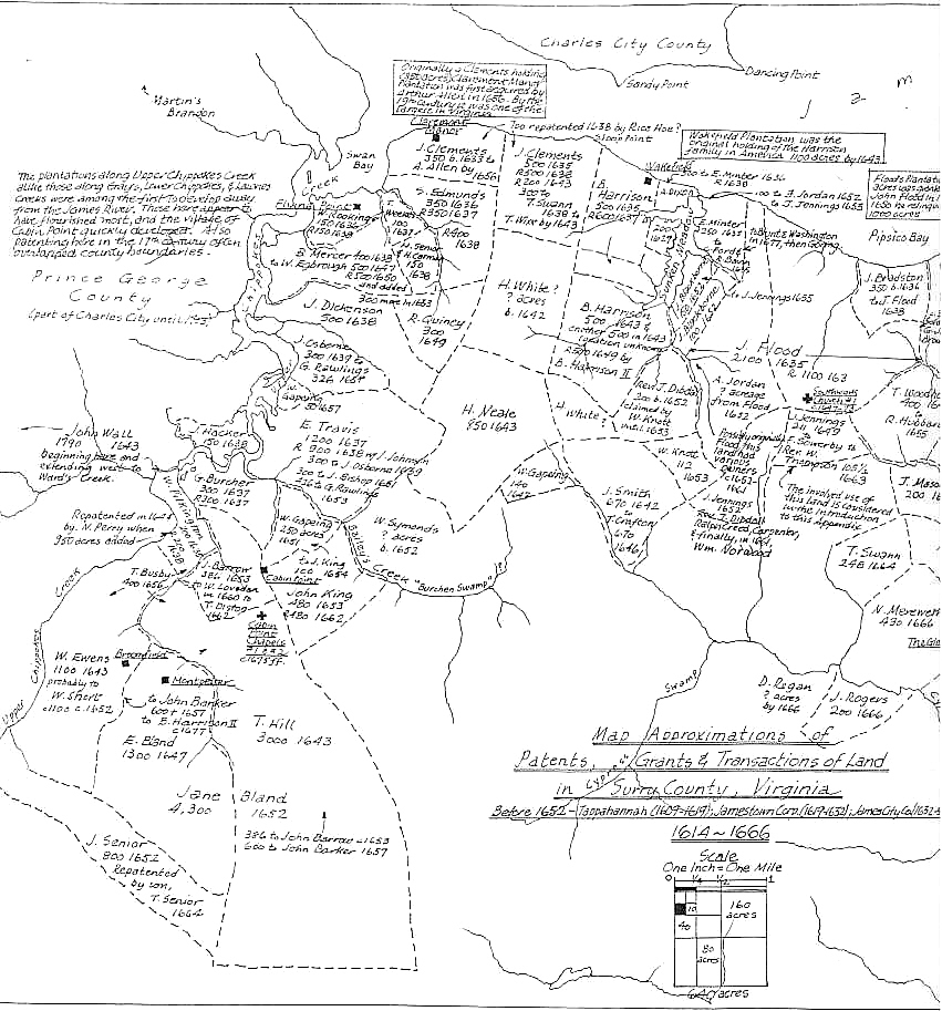
Surry County Land Patents #2
Surry County Land Patents #3
Modern Shenandoah Map
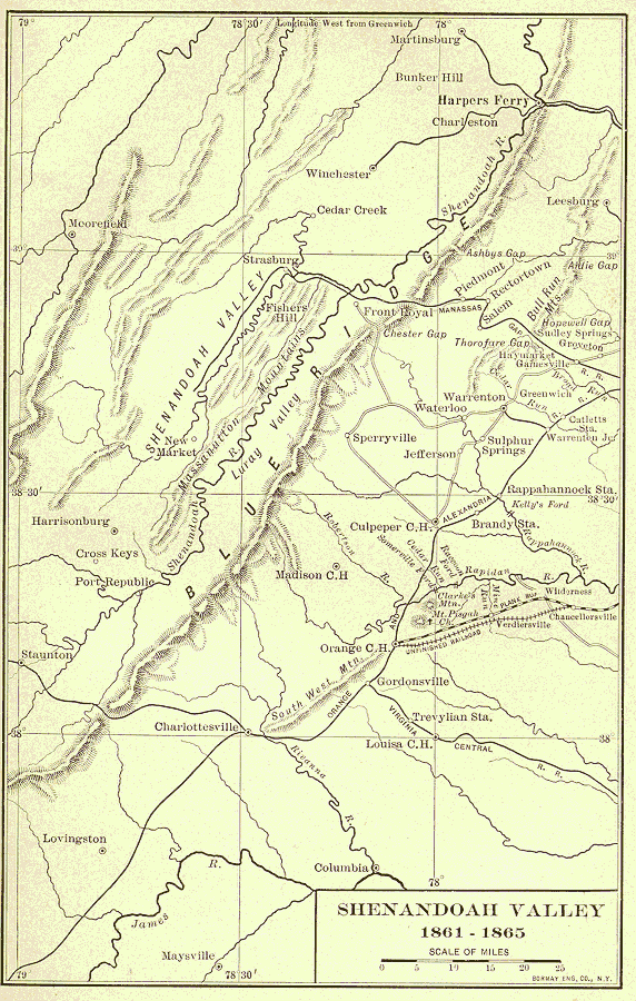
Shenandoah Valley 1800s
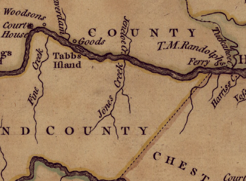
T. M. Randolph - Woodson
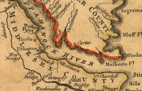
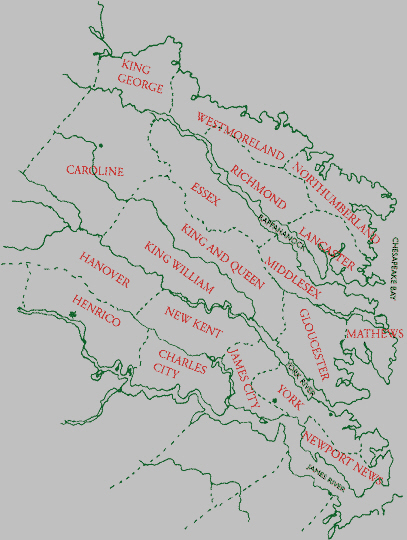
Tidewater Counties
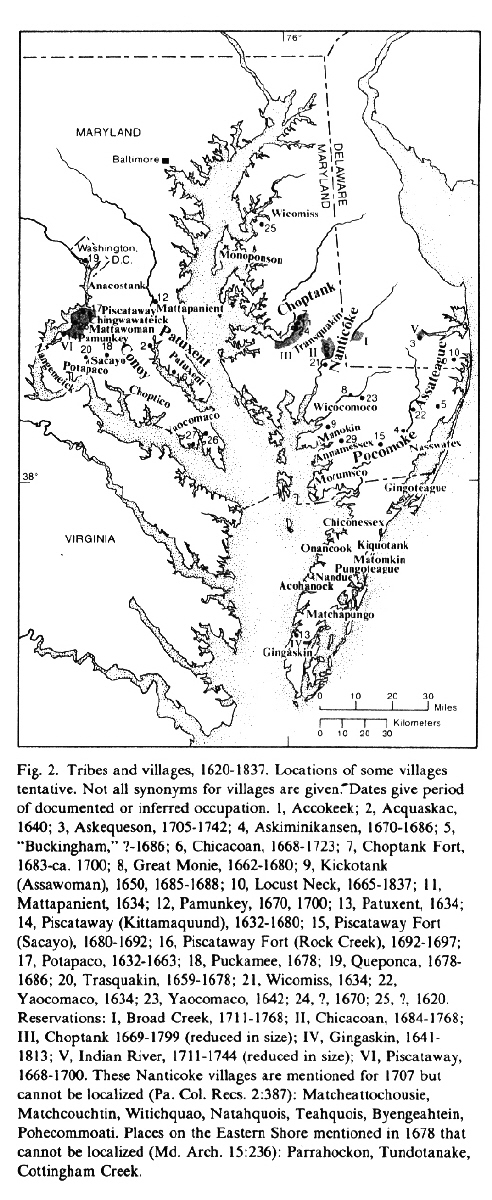
1620 Indian Villages
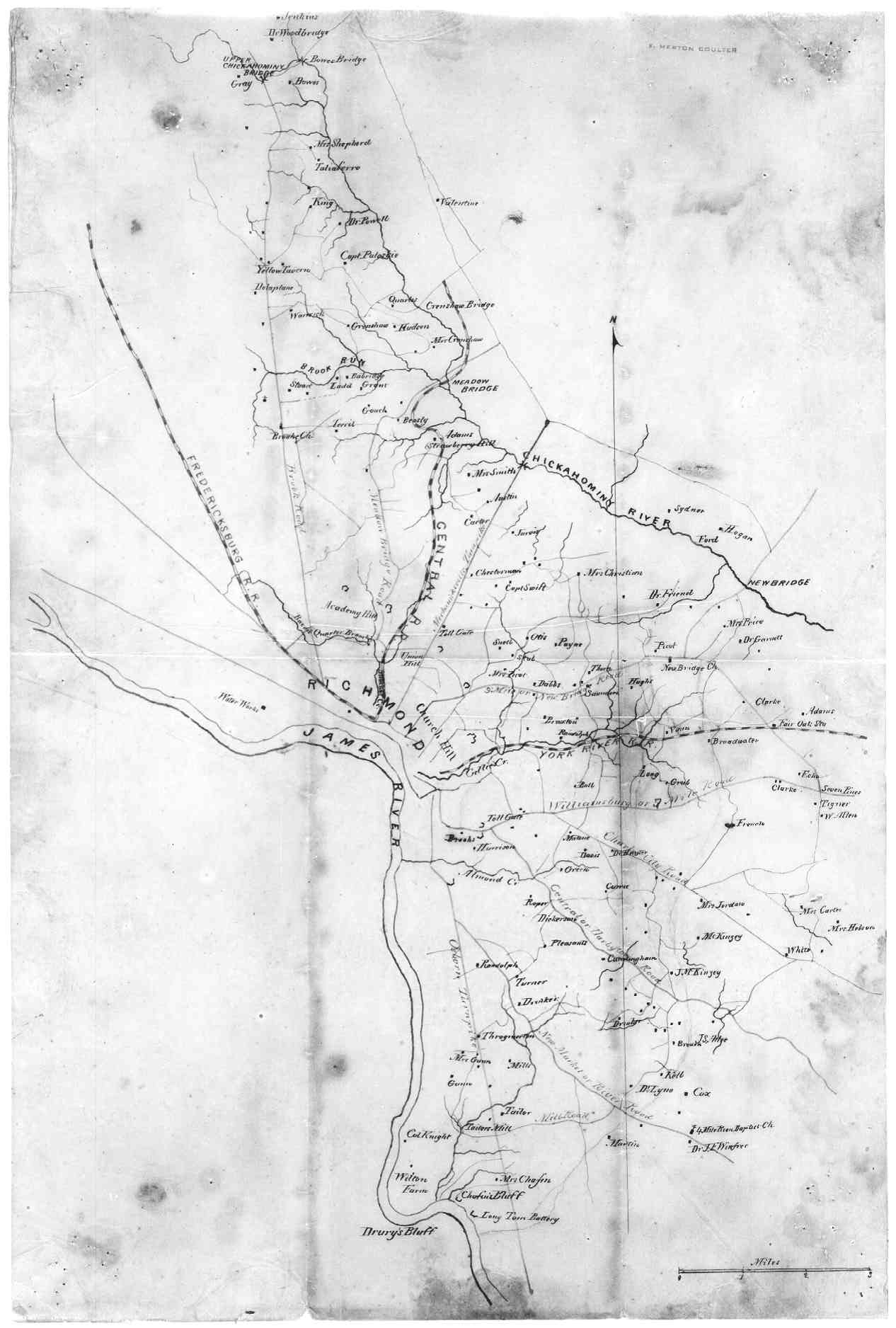
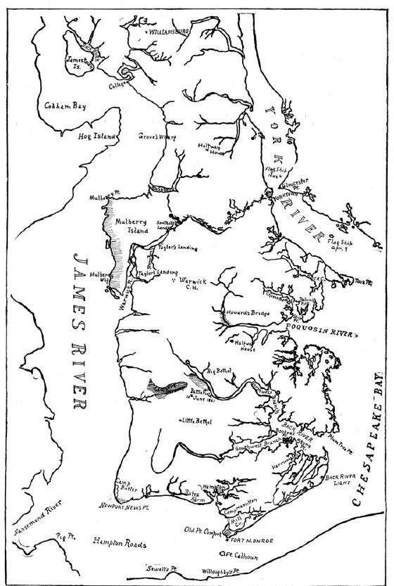
James and York Rivers
Reserved

